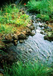
Water Source—Edge Integrity
This investigation assesses the type of vegetation found along a stream corridor or around a pond, an area that is known as "riparian." Typically edge habitats are among the first to be affected by human development, and the effect is usually to smooth out these habitats by removing the roughness of trees and plants to make room for beaches and docks.
 The investigation splits the riparian zone into three areas of activity: the shoreline (active erosion), dissipation zone (sediment deposition during high flow or water events), and extended floodplain. Each of these area plays a different role in a pond's or stream's function.
Equipment
- field tapes
- clipboards
- landowner's permission
- pencils
Investigation
Walk along the banks and through the area past all sample sites. Pay close attention to the age and complexity of the riparian community.
Record on a chart the types of vegetation for the three zones:
- shoreline—0-10 m (0-3 ft)
- dissipation—10-30 or 40 m (30-100 or 130 ft) [for pond or stream, respectively]
- floodplain—beyond 30 or 40 m (100 0r 130 ft) [for pond or stream, respectively]
Note: Aerial photos could be used in sensitive or large areas.
Scoring
An overall score = [(shoreline score x 3) + (dissipation score x 2) + (extended score x 1)] / 6
| Score | Grade | Function |
|---|---|---|
| 15 - 13 | A | well vegetated, good buffering, good connections |
| 12 - 10 | B | — |
| 9 - 7 | C | patchy or little vegetation, buffering, and connections |
| 6 - 4 | D | — |
| 3 - 1 | E | no vegetation, little buffering, and poor connections |
This content has been re-published with permission from SEED. Copyright © 2025 Schlumberger Excellence in Education Development (SEED), Inc.

